
Continuing the trend of June, the first half of July hasn’t been good for outdoor activities. There’s been an awful lot of water dumped on the North Country in the past couple weeks, and If the rain didn’t screw up the day, the heat would. It’s been hot and humid.
We’ve been okay in our neck of the woods. The flooding in Vermont was at its worst south and west of here, with all of the usual places flooding, in some cases more than has been seen for a while. Here in the Northeast Kingdom we had a few road washouts and closures, but that’s about it. Our garden is doing well with the water & heat, but the potted flowers don’t like it that much. I think the petunias are on their way out, and the pansies are looking shaky as well.
It’s been two weeks since I was last out on the trails, and last Friday morning I decided to head out to a trail near Berlin, NH that’s been on my list for a while- The Success Trail. This fairly steep trail connects to the Appalachian Trail on the White Mountains Mahoosuc Range. Temps for the day were forecast in the mid 80s with very high humidity, and – surprise!- thunderstorms on the menu for the afternoon. I don’t mind hiking in the heat, for once you’re in the woods it becomes considerably cooler, and at elevation usually cooler still. But I do not like hiking in a rainstorm, especially on an already wet trail. More on that later.
I got a late start, heading out for the trailhead mid-morning, and arriving there just before noon. The last five miles were over a dirt road that was not in the best of condition. Beware- this road is not for low-clearance vehicles.
Given the late start and the t-storms forecast later, my goals for this jaunt were:
-Get up the trail to The Outlook spur, and take that in.
-Complete the Success Trail to the AT.
-Head up to Mt. Success summit if time & weather permitted.

This trip was the debut of my new slack pack. After almost 20 years of using the old Fieldline bag, last week I decided to downsize the pack and upgrade the quality. After some research I settled on the Gregory Miko 20. It holds everything I need on a day hike, and the side pockets each easily hold 1-liter water bottles. It is set up for a hydration bladder, but I’m still not into those. What sold me on this pack was the hip belt. Many small packs have them these days, but this was the only one I found that was actually load-bearing and comfortable.
So I checked through the pack, chugged a half liter of water and saddled up. Onwards and upwards!


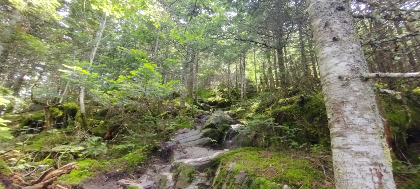
The first part of the trail is a short two-track, which I think originally was the road to the parking lot for this trail. It’s now obstructed by a boulder, and there’s really no parking at the trailhead except on the side of the road. Once you reach the end of the road, there’s another sign guiding you into the woods. Out of the sun and into the damp, cooler forest.
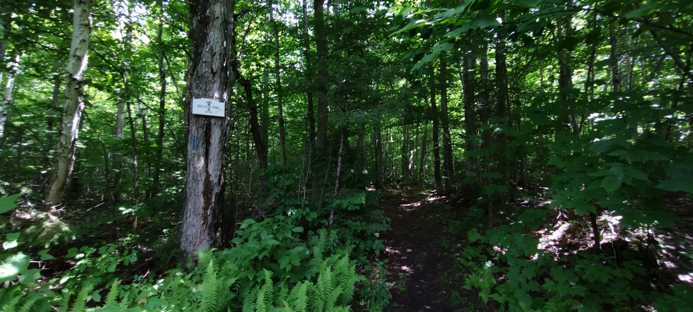
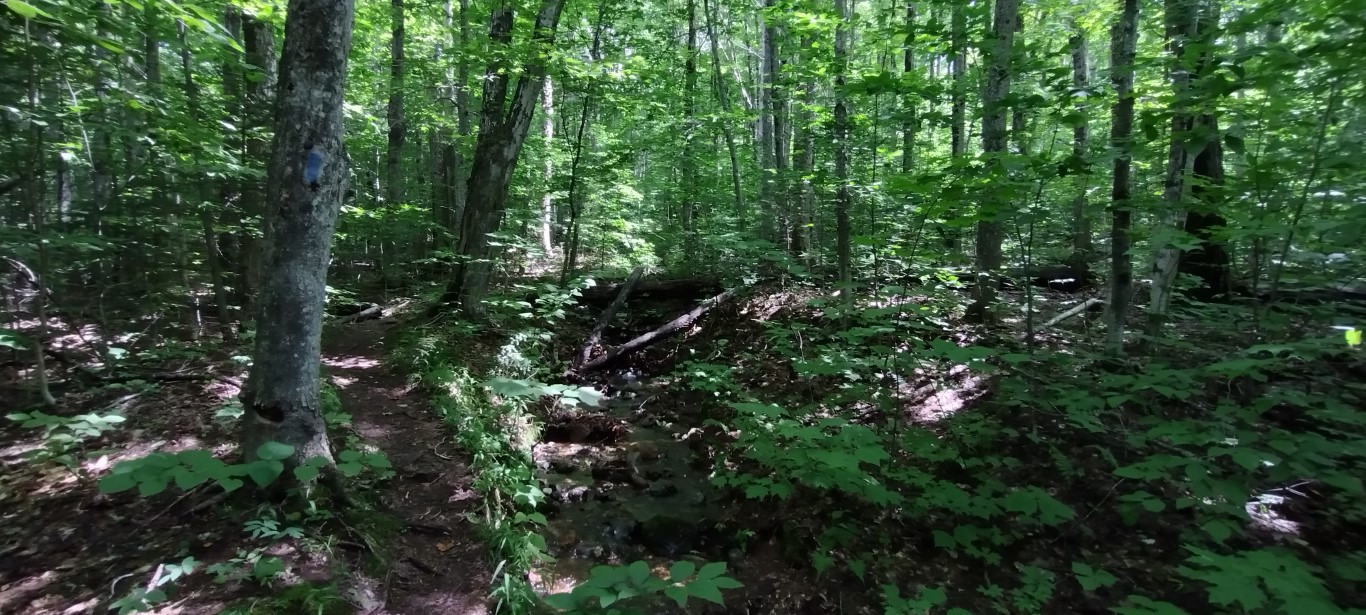
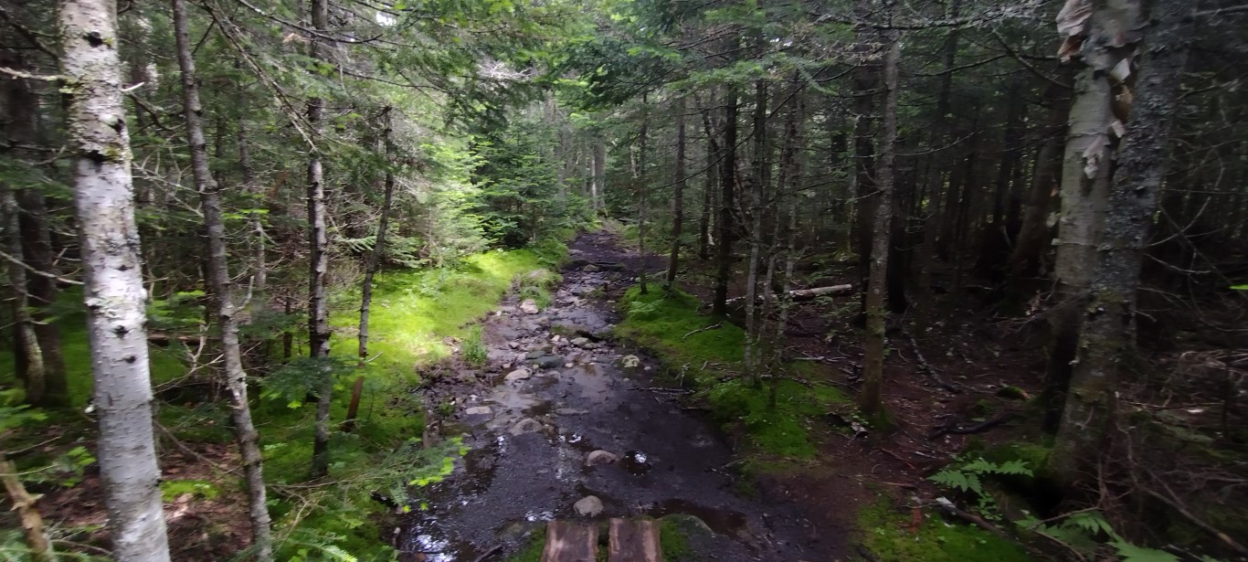
From this point on the trail was wet, and pretty muddy in places. Steep too, as bare rock soon appeared, and it was also wet. I’d say the first mile and half of this trail was consistently in the high 20s / low 30s grade-wise, with some parts approaching 40%.

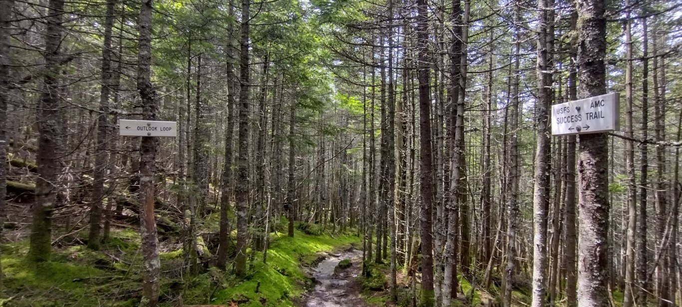
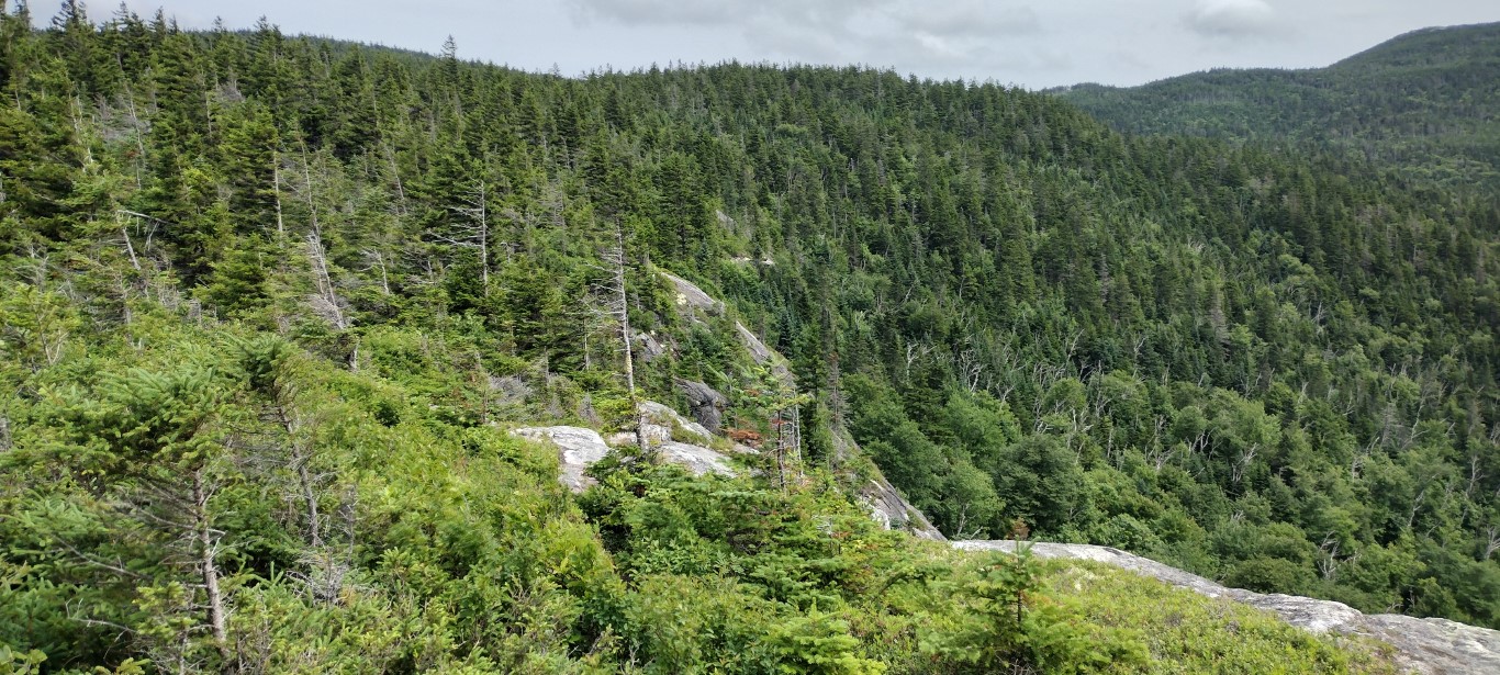
Due to the wet and mud the going was harder than usual. A lot of side-to-side action. I didn’t see any critters, but there were plenty of birds flitting through the trees. I did see some small bear tracks in the mud, and plenty of trailside fungi. At the 1.5 mile mark The Outlook spur broke off the trail to the right, and that’s the way I went.

The loop is short, only 2/10ths of a mile, but the views out there are fabulous. I spent about a half hour in the sun and wind enjoying the views. Here are a couple of photos:


The Outlook promontory is a rocky knob jutting out of the ridge to the southwest. As luck would have it that day, the wind was coming directly from that direction and it was howling once away from the cover of the forest. Here’s my attempt at a video of the panoramic view.
Apologies for the finger in the frame. With the wind and all, hanging onto the camera while panning was a challenge.
The spur trail continued along the edge of the knob, and back into the forest where it reconnected with the Success trail.

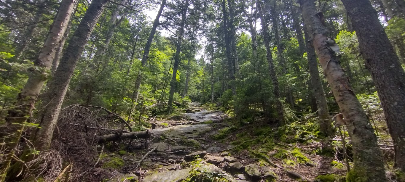
At that point the trail flattened out considerably as it followed the top of the ridge. While I thought the first 1.5 miles of the trail were wet, this section brought a whole new meaning to the word, as flat terrain meant more standing water.

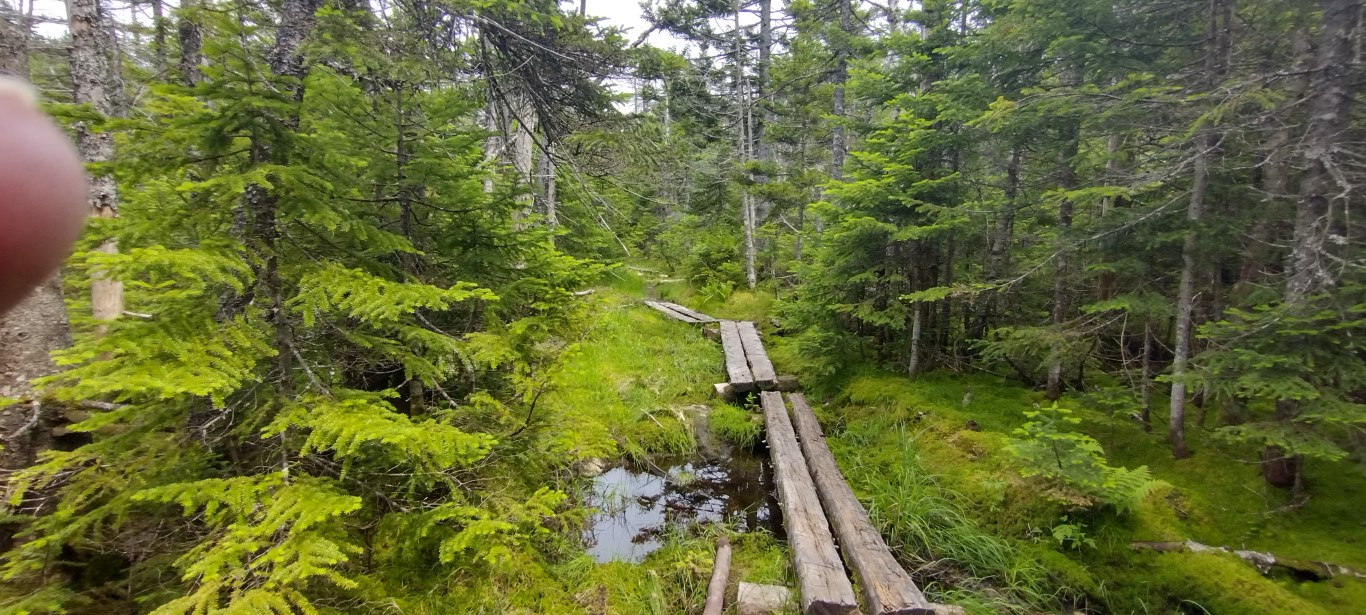
There were a lot of bog bridges in that last ¾ of a mile before reaching the AT, and a lot of mud where there were no bridges, or where they were submerged or damaged and unusable. It’s pretty obvious that section of trail needs some attention, if and when it dries out enough to do it. I would have paid money to watch some of the flip-flop crowd traverse that part of the trail. 😆
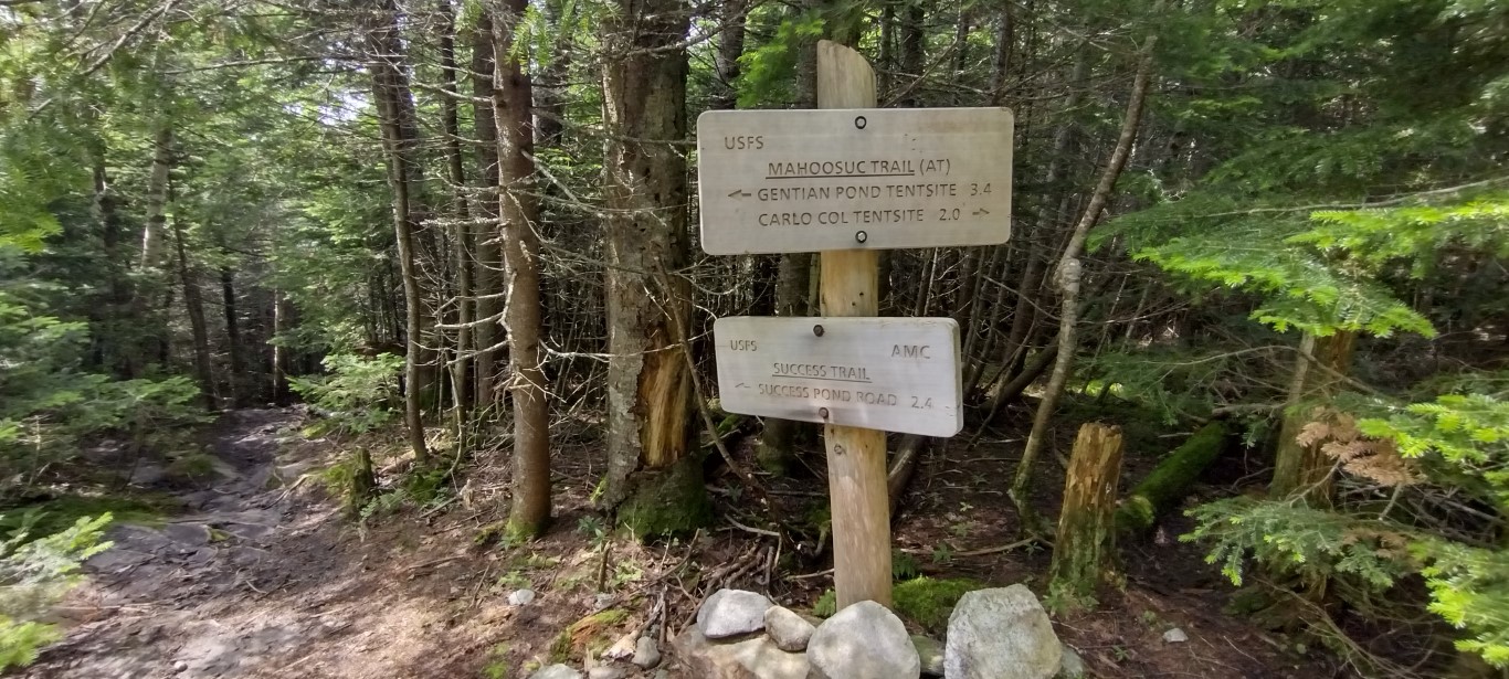
Eventually I made it up to the AT, or as that section is known, the Mahoosuc Trail. I turned right and headed along it for a quarter mile or so.
It was now closing in on 3PM, and decision time loomed. Thunderstorms were forecast from 4PM on into the evening. The top of the hill was about an hour away. While I am prepared for rain while on the trail, I did not want to retrace my steps through the already saturated bogs and mud puddles during a tropical downpour, and I certainly did not want to be on an open rocky summit if lightning was on the menu.
So I reversed course and began the trip back to the trailhead. In some ways it was harder than the ascent, as downhill mud and wet leaves present their own challenges. The trip back was without incident, and I made it back to the Transcontinental Jeep a few minutes after 4PM.
It did not rain on the way out of the woods, but it did on the drive home and there were ferocious storms that night. Discretion; better safe than sorry, and all that- the mountain isn’t going anywhere.
Elapsed time for this sojourn was about four hours, including breaks and dawdling time at The Outlook. Elevation gain was just under 1800 feet, and water consumption was about 2.5 liters. Like I said, it was hot. And humid.
I’ve got several adventures planned through the end of July, and I hope the weather settles out enough to accommodate them. Camel’s Hump and Percy Peaks are next up, and I’m hoping to attempt the Franconia Ridge hike around the end of the month. Beyond that I dare not say!
Thanks for stopping by, and if you enjoy reading about the wanderings of an old incline junkie, consider making my day by liking and subscribing to this blog. Happy Trails!

I am planning on Success as my final 52 in a couple of weeks. Thank you for the detailed description.
I hiked North Percy Peak yesterday! It was spectacular!
Enjoy!
Congrats on your upcoming completion of the 52 list!
The finger in the frame didn’t distract at all. Amazing place and super photos 🙂