
It’s been a few days since my last posting, as time last week escaped me. It’s now fall, and cleaning up the grounds and preparing for winter is the order of the day. It’s not unusual for the first snowfall to arrive as early as the first of November here.
There hadn’t been a hike since Mt. Cube a couple of weeks ago, unless one counts another walk around Echo Lake (I don’t). I was planning on no walking this past weekend either, as I had some dental work done Friday that had been put off for a while. I figured I would not be up to anything too rigorous for a few days after that procedure.
Wrong again. By Sunday I was feeling semi-grand, and itching to get out and about. So I did.
Not far from here is the northern terminus of the Long Trail. This trail was built in the early part of the 20th century and runs along the spine of the Green Mountains for 273 miles, from the US-Canada border to Williamstown, Massachusetts, at that state’s border with Vermont. The trail I walked Sunday is aptly named Journey’s End, and it’s a 1.3 mile trail that connects that northern terminus to a narrow dirt road in North Jay.
I arrived at the trailhead later in the morning, finding five other cars in the small parking lot. I slid the Jeep into the last open spot, and saddled up for the hike, walking down the last few yards of road to the Journey”s End Trailhead. Note the celebratory offerings at the base of the sign. These are intended for northbound through-hikers completing the Long Trail. It’s a nice touch.


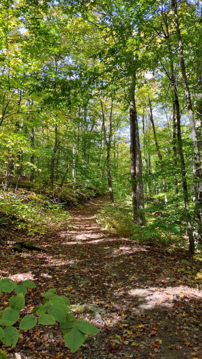
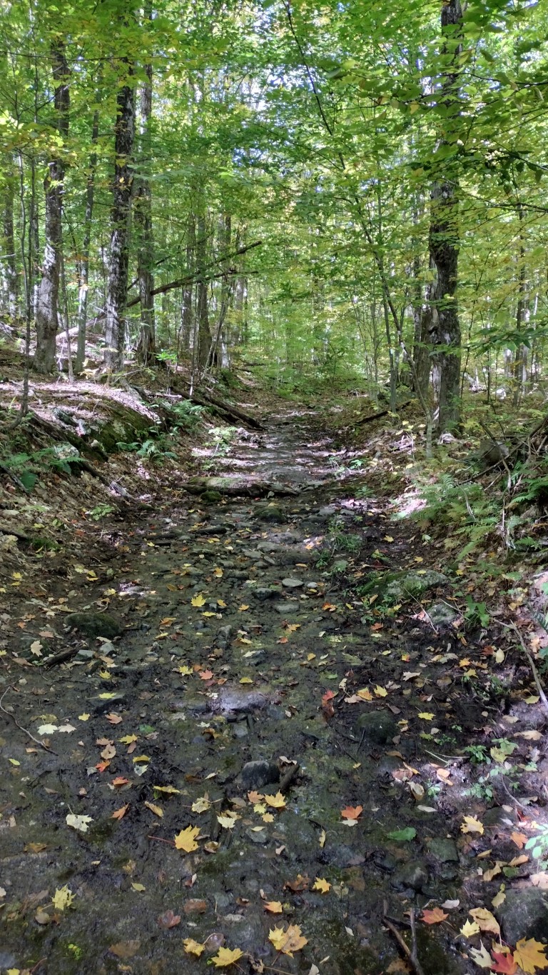
The trail began wide, and narrowed as it progressed into the woods. The foliage was typical for New England at this time of year- it’s about a week shy of “peak color”, but impressive nonetheless. The trail was littered with downed leaves, and was also quite wet and muddy in areas. This isn’t surprising as it has rained quite a bit over the past two weeks. But this Sunday was bright, sunny and cool, with the temperature hovering in the mid 50s.
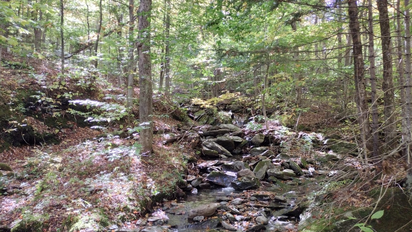
About ¾ of a mile along the trail you come upon a stream tumbling down from the ridge. I’d bet in the spring this one carries a lot of water, but in October, not so much. Still, it was running water, and pretty in the slanting autumn light. Here’s a photo and a short video.
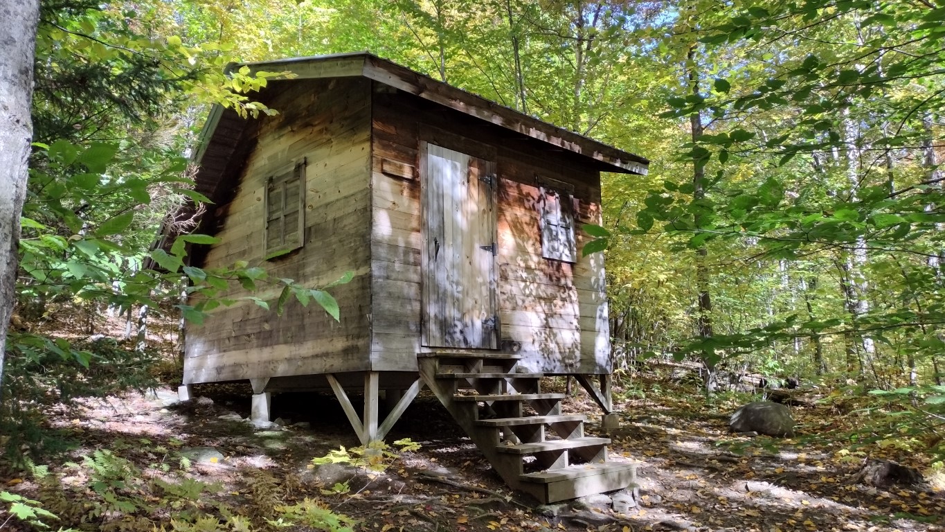
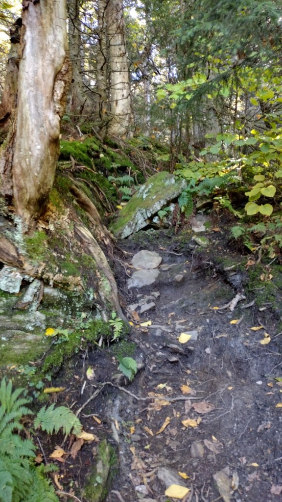
After crossing the stream the trail increases in steepness, beginning with a nice stone staircase that takes one over the embankment. The path heads steadily uphill and soon the first (or last) shelter associated with the Long Trail, Journey’s End Camp comes into view.
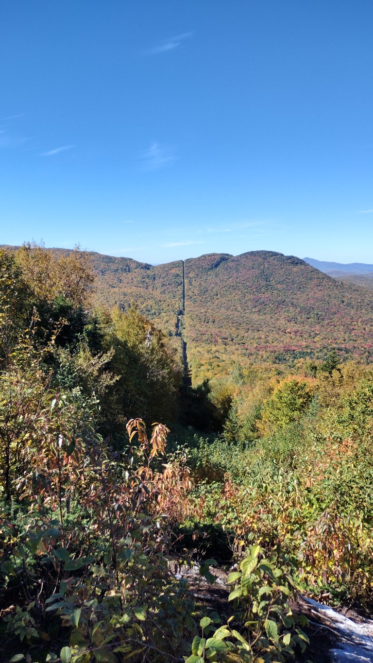
Continuing up the hill along the muddy path, in roughly a half mile the trail ends at the US-Canada border, and also meets up with the Long Trail. This provided the only real scenic view of the walk, as you could look down along the clearly defined border between the countries. There’s also an old-school obelisk monument here.


The entire Journey’s End Trail is only a little over a mile. My decision now was whether or not to turn around and head back, or head south along the Long Trail for a bit. The first summit on the trail, Mt. Carleton, was about two miles away. Seeing as I wasn’t ready to call it a day, southwards I went towards the 79th tallest mountain in Vermont.
The trail got tighter and steeper on the Long Trail. And muddier. The trail was well marked with white blazes, and was in good shape despite the mud. I swung along at a comfortable clip towards Carleton, and in about an hour reached the sign declaring the summit. There was a short spur trail towards a “lookout”, but there was no view to be found. Maybe there is one when the leaves are down.


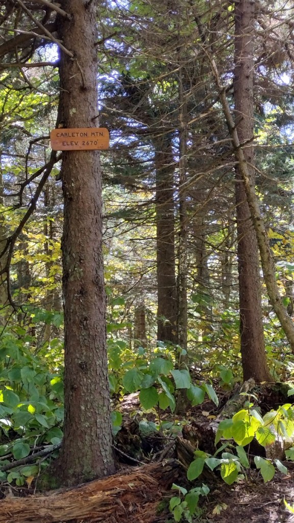
I was thinking about the name of the mountain, and found it odd to see that particular name on this side of the US-Canada border, seeing as General Carleton was a successful antagonist of the Americans during the Revolutionary War. His name is littered about in Canada, along with others sharing that surname. Once home I did a bit of research and learned my assumption of source of the mountain’s name was as wrong as could be. Mt. Carleton was named after a man that participated in building the Long Trail a century ago. There are several other peaks in this neighborhood also honoring other trail builders. I like that.
After a short hydration break I reversed course, and headed from whence I came. When I came upon the Long Trail informational sign again, I noticed that new offerings to finishing through-hikers had been added.
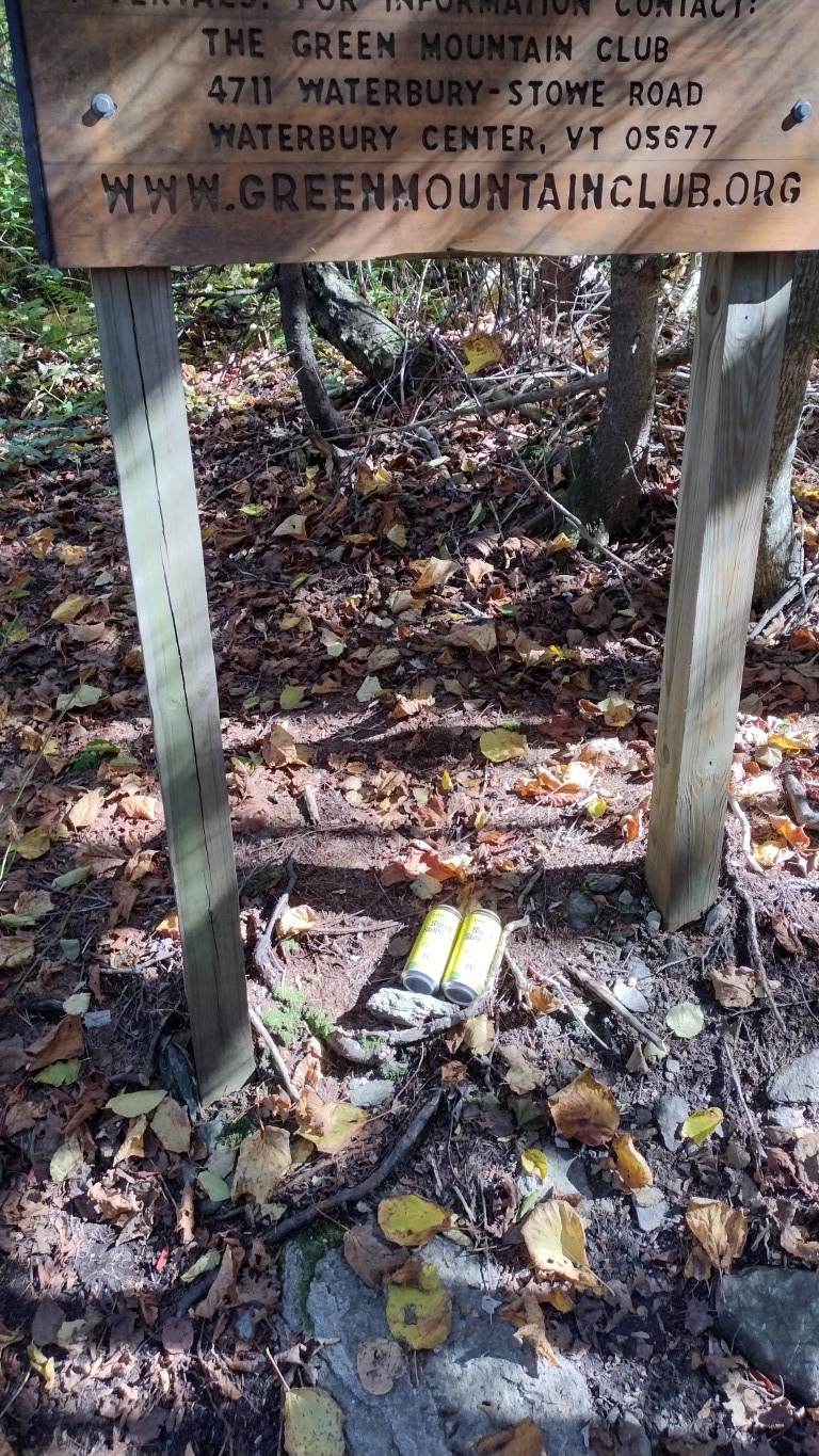
During the walk I encountered six other people, so I’m assuming that one of those folks had dropped off the beers. They were not there when I first passed the sign. Early October is a time when many of the through-hikers complete their walks, and I’m told most travel south to north.
I’ve been toying with the idea of walking the Long Trail next year. Aside from last weekend’s hike, and previous excursions up Jay Peak and Mt. Belvidere, it would all be new to me. The trail having many shelters along the way is attractive, for while I don’t mind sleeping bags and mats, I hate tents. But I’d have to carry one anyway, just in case.
If I do this, the next step would be building a super lightweight backpacking kit, and carrying the full load through a series of day hikes and overnights next season, building up to making the Long Trail trip beginning sometime in September 2023. I do wonder if I might be too old for this? The legs and lungs are fine, which makes it tempting. We will see.
And if I do this, I will walk north to south, because that’s how I roll.
Sunday’s walk covered 6.84 miles, with an elevation gain of 1421 feet. It took 3 hours and 22 minutes. Here’s a map of the route.

The next (and last) planned mountain hike is scheduled for next weekend at Tumbledown Mountain over in Maine. Youngest Son is planning to go, and right now the weather forecast is saying cloudy but dry. If the weather stays dry, we’ll be hiking.
That’s it for today. Thanks for stopping by!

Looks like a great hike. I miss New England in the autumn. Loved the photo of the US/Canadian border. It must be a job keeping that line clear of trees.
Here’s what they use, Mike. https://youtu.be/_FG89hKbXLQ
That border looks innocuous, but there’s a lot of monitoring, both visible and hidden. We get quite a bit of activity in the less rugged areas over towards New York. A couple weeks ago 52 folks were apprehended coming in from Canada. They were mostly from Mexico and Central America- they fly into Canada and try the northern border.
Wow! It’s like a weapons-grade lawn mower. I suspect keeping that border clear is like painting the Forth Bridge–as soon as you’re done, you have to start over.