

It’s been busy around Pondside since the Table Mountain hike late last month. Garden 2024 has been fully installed over the past two weekends, and I’m again optimistic that it’ll be another great season.
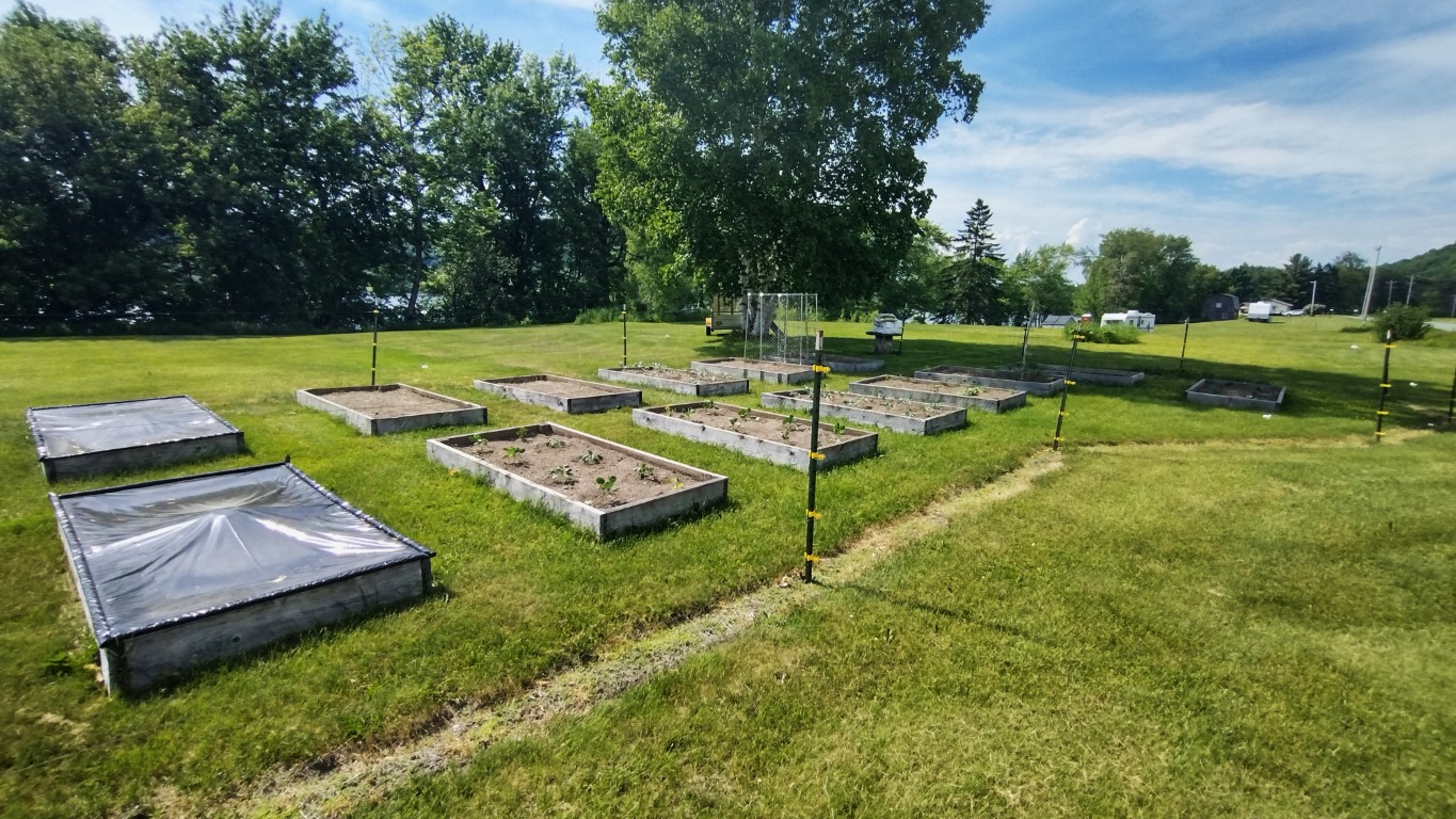
Of course, there are always things to worry (obsess?) about. The wet spell we had gave way to the heat wave we’re now experiencing, featuring several days of 80+° temps, making daily watering of the garden necessary. But you have to be careful of overwatering, especially the broccoli and Brussels sprouts- they do not like that.
However, the onions will take all the water they can get. They’re on the worry list due to showing some yellowing, which can be due to not enough water or nutrient deficiency. The bed was fertilized, and I think they’re getting the right amount of water, so……………
As the saying goes, if that’s all you have to worry about, you’re doing alright. I’m sure everything will work out in due course. It always seems to.
Meanwhile, the cilantro hasn’t sprouted.
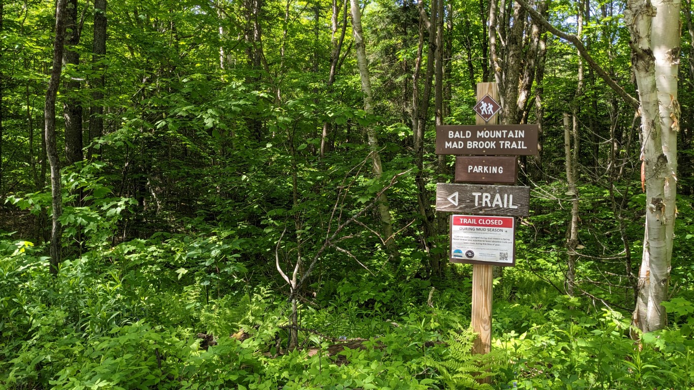
Getting the garden in hasn’t slowed down the hiking. This is the time of year I reclimb several of the local hills, and this year I started with Bald Mountain in Willoughby State Forest.
I traveled the Mad Brook Trail for the first time. This trailhead is not far from the house, and took about 15 minutes to get to last Friday. The day was sunny and warm. The trailhead is located on Mad Brook Road in East Charleston and there is parking for 6-8 cars. I was the only visitor that morning.
The well-marked trail starts out crossing some private property. If you decide to try this one, please be respectful of the area, and stay on the marked trail.
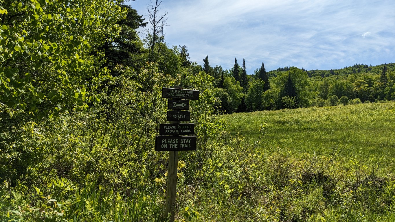

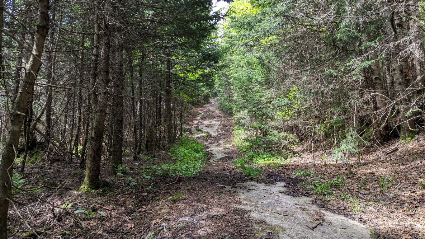
The trail enters the forest after crossing several hundred yards of open field. There it follows an old woods road for quite a spell. The path is fairly flat, until about the 1.4 mile mark when it’s time to cross Mad Brook.


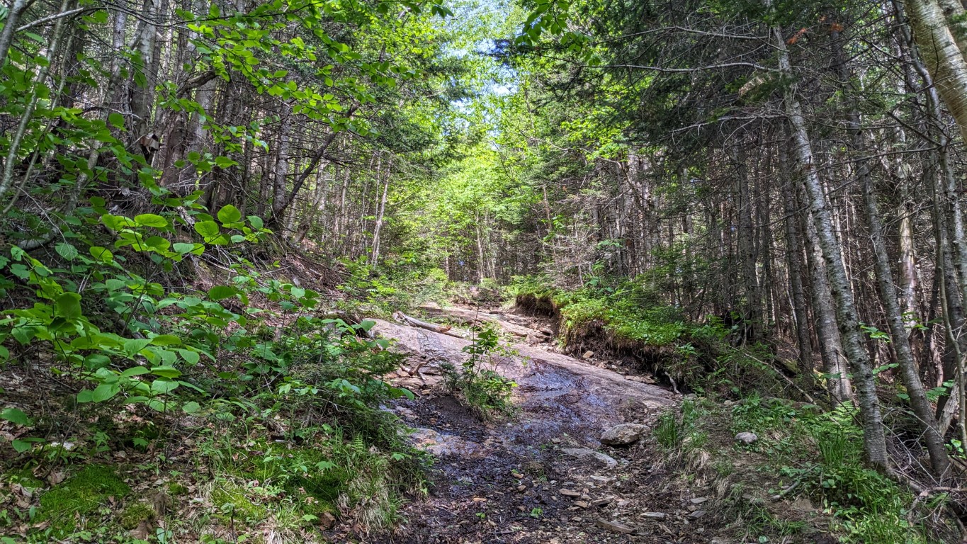
At his point the trail begins to go up, with the incline becoming increasingly greater. This part of the trail was much wetter, with many muddy patches. They were all easily navigable. Bear in mind this is an old Vermont trail- there are no switchbacks. To go up, you go up! There was also a lot of moose scat on this section of the trail- kept coming upon it almost to the summit.


The only tricky part of the hike that day was on the ledges, which show up perhaps ⅓ mile after crossing the book. Many of them were wet, and most of them had some mud and leaves covering the rock. Foot placement was important.

At the end of the trail the ledge breaks out into a small clearing at the summit. There is a cabin and an old fire tower there. The summit is forested, as so many of Vermont’s mountains are, so climbing up the fire tower is the only option to see the surrounding countryside. The views are magnificent, especially in the fall.
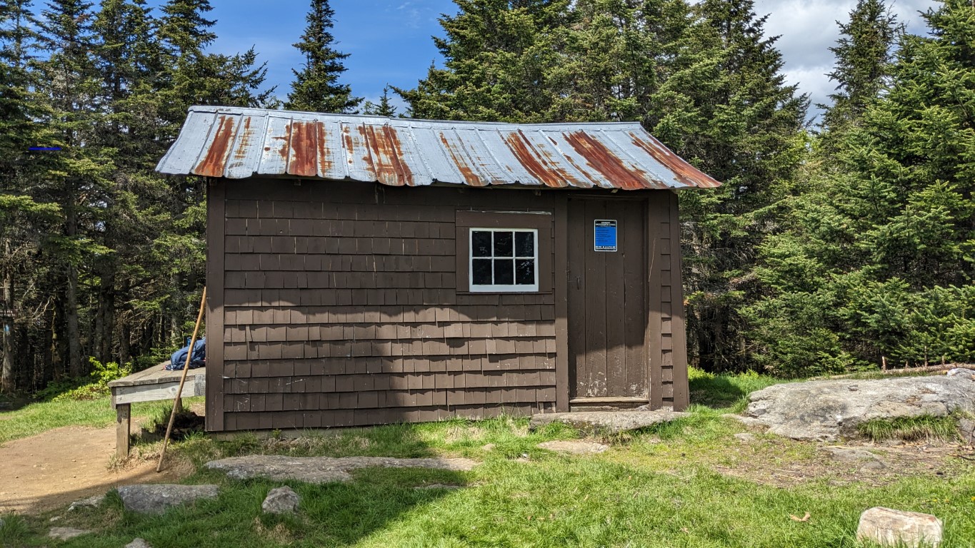

Having been up Bald Mountain several times, I passed on the firetower this time. You can either wait until you get there to see the views for yourself, or check out this post from last year when I spent the night on top of the mountain. There are many photos and videos in that post.
Going down the hill was pretty quick once clearing the wet ledge. While descending, I met a couple of guys heading up. They were the only folks I saw that day.
The out & back length was 5 miles, with an elevation gain of just under 1500 feet. The walk took 2 hours 25 minutes to complete.
I headed up Mount Pisgah yesterday after spending most of last weekend planting the more sensitive seedlings; tomatoes, peppers and the like. Also finished all of the direct seeding, too. That included cukes, squashes, green beans and some assorted herbs.
I went up the North Trail, which is the trail I prefer. It’s shorter than the more popular South Trail, but more steep. It’s also usually cooler as it approaches the summit from the northerly side. This mattered Monday as it was another day in the 80s.
The trailhead is about 9 or 10 miles from Pondside, and the small parking area was vacant when I arrived mid-morning. After saddling up and hitting the trail, my belief that I was first on the trail that day was confirmed by the volume of cobwebs I cleared while hiking.
The trail was still pretty muddy in some places, but it was all easily avoidable. The water crossings were easy, and the staircase climb to the top was just as challenging as I’d found it in the past. I didn’t take any photos on this walk- if you want to see some of that trail, check out this post.
Although I didn’t see anyone on the hike up, folks began filtering through not long after I reached the summit. By the time I’d returned to the trailhead I’d met 6 or 7 people and a couple of good dogs on leashes, as they should be on the trails. It was pretty warm when I exited the forest. This hike covered 5.2 miles with an elevation gain of 1565 feet, and took 2 hours 35 minutes to complete.
That’s it for today. I’ve got quite a few hikes and climbs penciled in for the summer, and hopefully I’ll be able to complete most, if not all of them. Summer is now in full swing in the Northeast. I hope you enjoy yours as much as I plan to enjoy mine!

