
Those of you that have been following these posts are probably aware that I’ve been leading up to something this summer. The previous hikes and climbs all have added experience I felt necessary before tackling a major effort. Elevation gain, incline and distance were all factors leading up to the latest adventure, the Franconia Ridge Loop in New Hampshire’s Franconia Notch State Park.
At the beginning of July I’d penciled in this climb for August 2d. But with the wet and hot weather I had little hope of hitting that date, and as of the end of July I hadn’t finished the list of prerequisites. Then a window of opportunity appeared last Sunday- the forecast for Wednesday, August 2d was dry, bright and sunny, and most importantly, cool. The forecast held, and Tuesday I decided to go for it the following day.
Franconia Ridge is the taller set of mountains, forming the east wall of Franconia Notch. The loop uses the Falling Waters, Franconia Ridge, Greenleaf Hut and Old Bridle Path trails to form a roughly 9 mile circuit. The mountains traversed, from south to north are Little Haystack (4725 ft.), Mt. Lincoln (5089 ft.), North Lincoln (5000 ft.), and finally Mt. Lafayette (5250 ft.).
Having hiked up the Old Bridle Path to Lafayette many years ago (1979?), I decided to take the route counter-clockwise, and head up to Little Haystack first.
I arrived at the trailhead parking lot around 9:30AM, and despite the huge amount of parking, managed to get one of the last spaces. This trailhead is one of the most popular in the White Mountains, perhaps second only to the Pinkham Notch facility at the base of Mt. Washington. Even mid-week these trails are crowded.
The weather was as promised. It was bright and clear, with the temperature in the low 60s as I hydrated, got my gear sorted and headed for the trailhead.

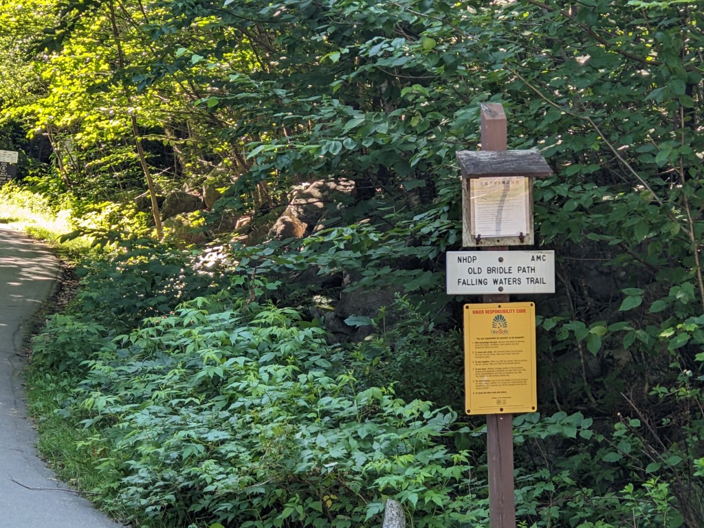

It’s a single, well-worn and wide trail for the first 2/10s of a mile. At that point the Old Bridle Path breaks off uphill to the left while the Falling Waters Trail goes to the right across the bridge over Walker Brook. A nicely carved stairway leads the way upwards into an ascent that doesn’t quit until the Little Haystack summit.
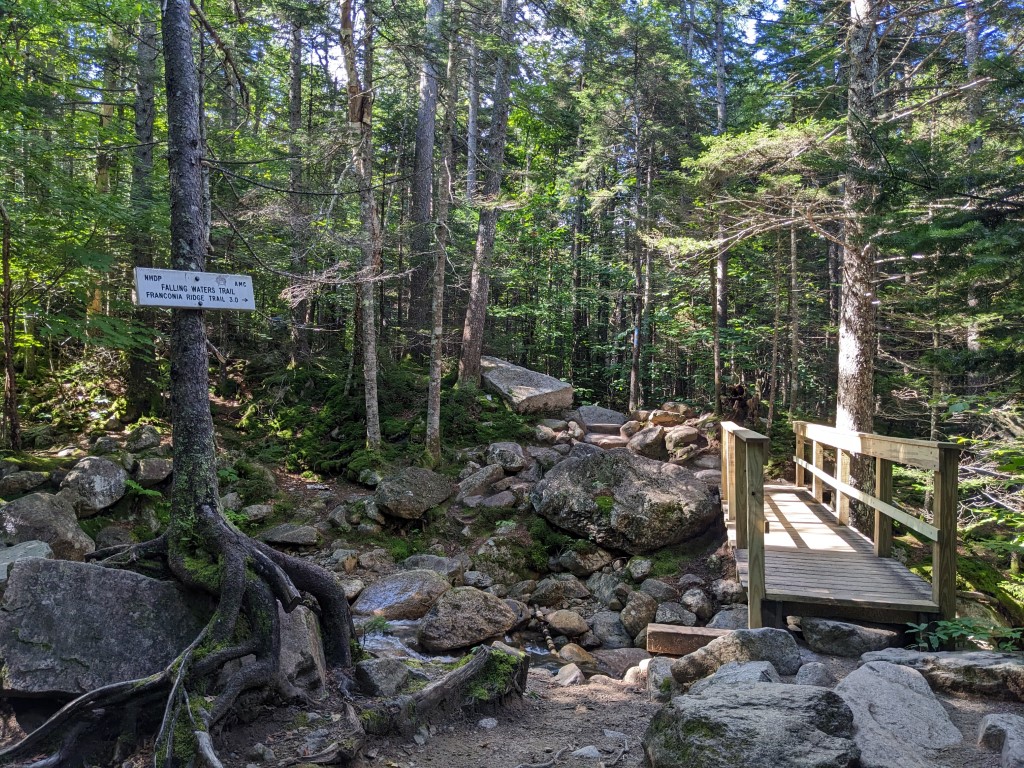
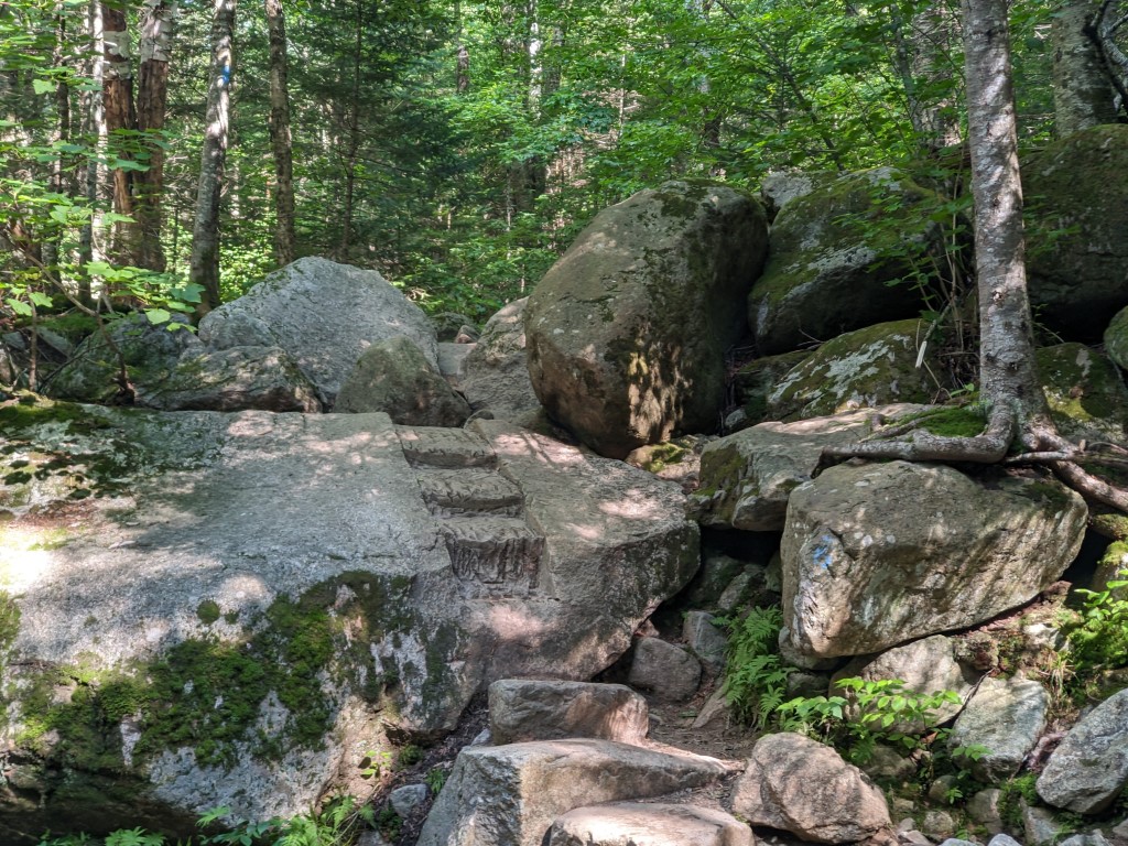
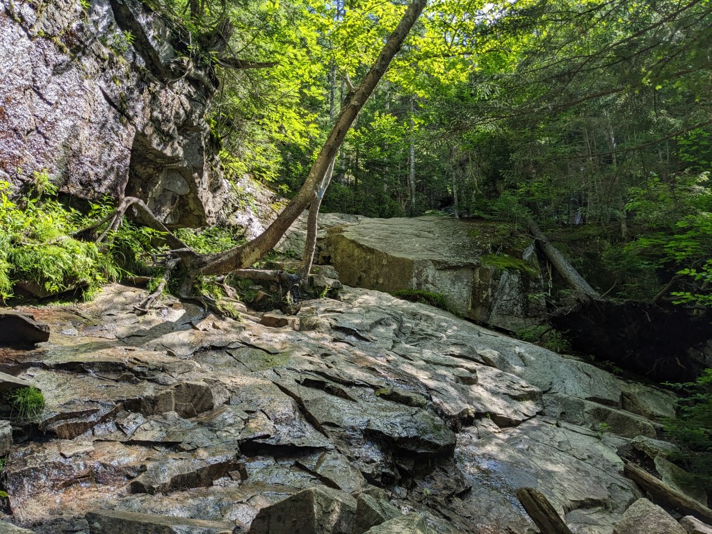
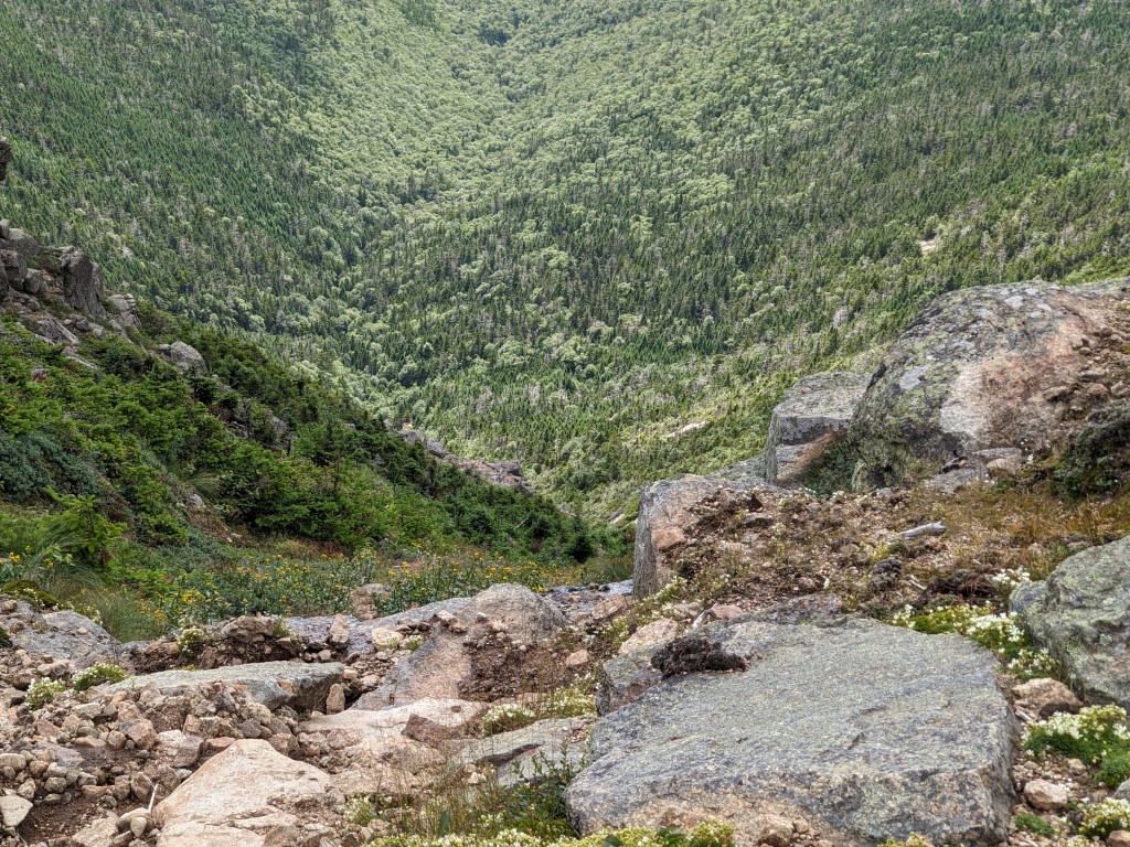
The Falling Waters trail heads more or less southerly for about a half mile, where it crosses Dry Brook for the first of several times on the ascent. While the incline at this stage is relatively gentle, the boulder fields make their first appearance.


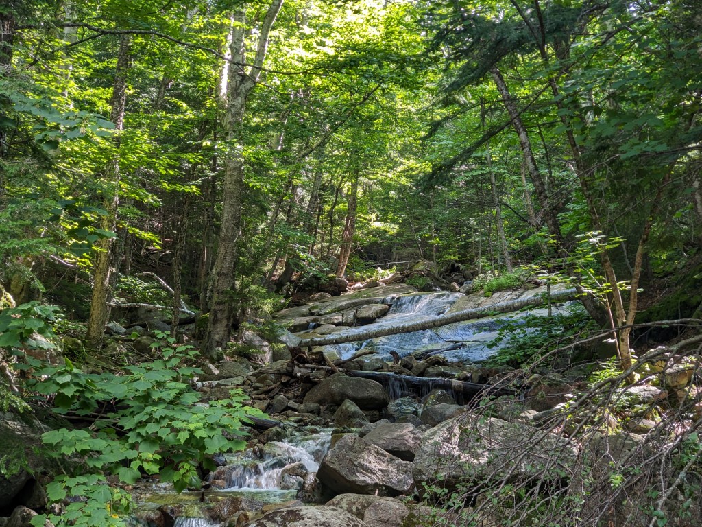
Once reaching Dry Brook, the trail follows it for almost ¾ of a mile, crossing it several times and always going up. There are several waterfalls along here, some big, some small- all stunning. Being a sucker for waterfalls, I took several videos and many photos through this stretch of the walk. Here’s a sampling:
The best of the still shots:
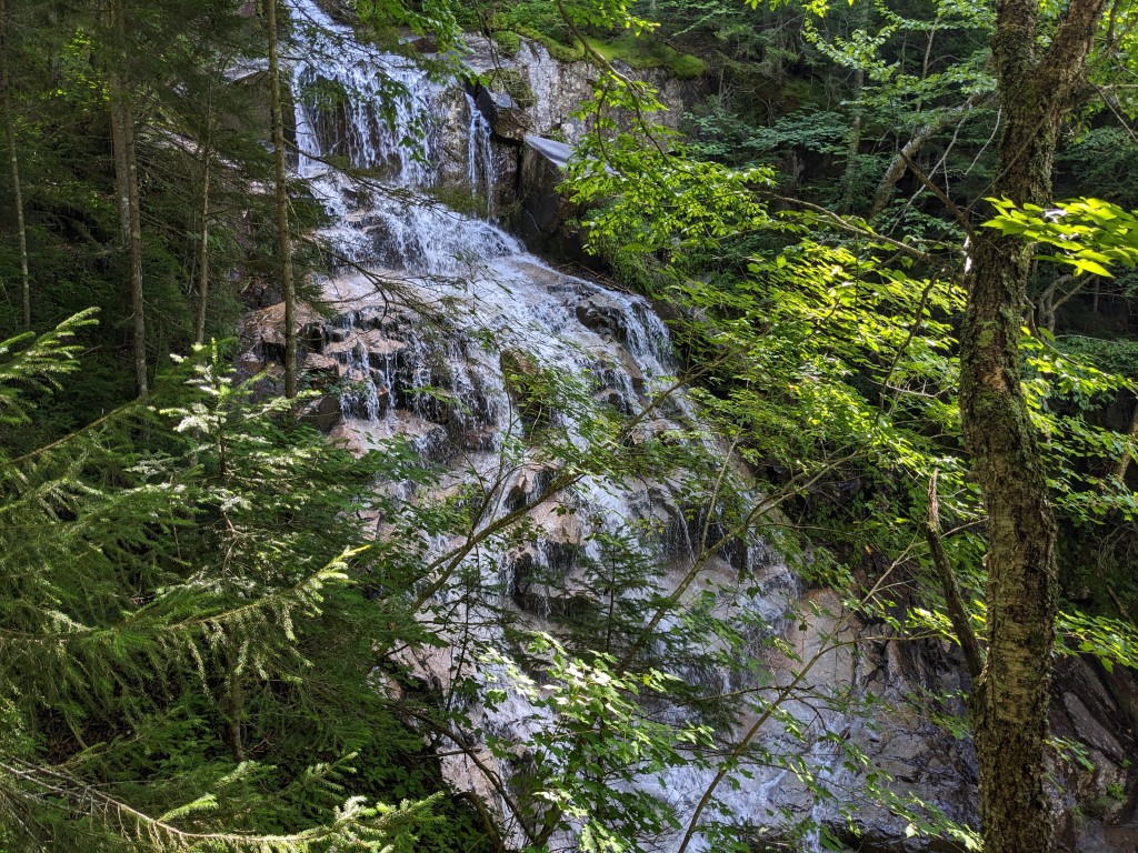
The largest of the falls. Dry Brook isn’t, really!
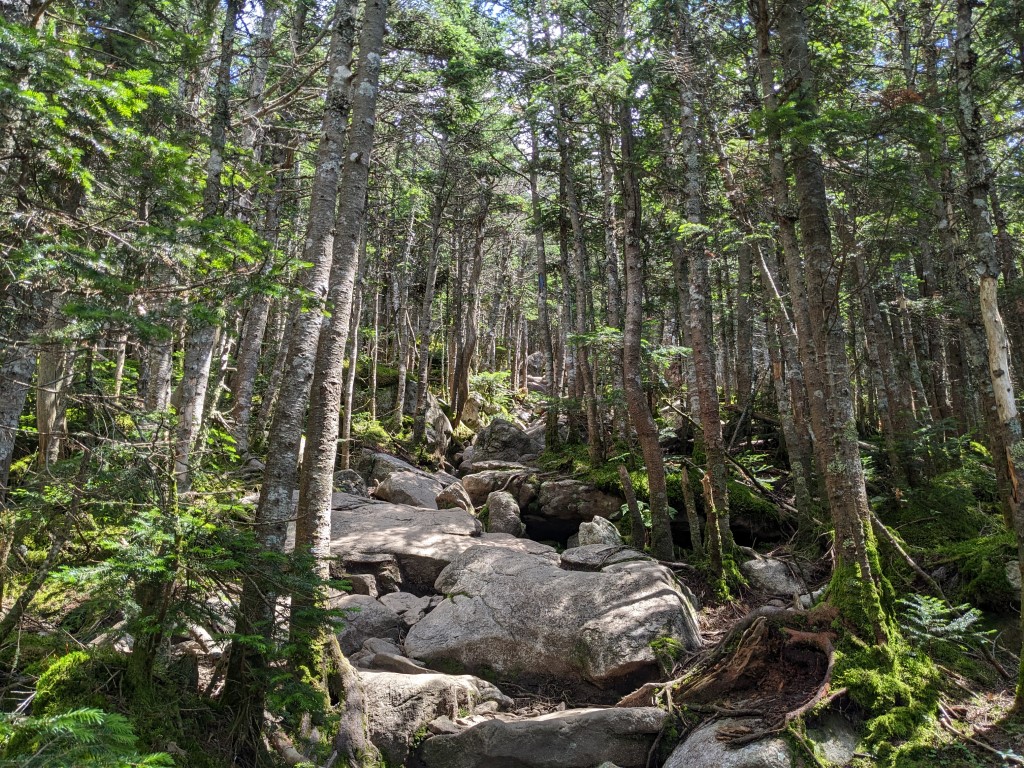
The trail entered a series of switchbacks after leaving the brook, and while this kept the grade at a reasonable level, the boulder fields reappeared in earnest. I’d read reviews calling this loop a “nonstop Stairmaster”, and have to agree with the description. By the end of the day my pedometer would register 45,000 steps.


Eventually I came upon the informational sign regarding alpine ecology, advising hikers to be careful when walking above tree line. Then it was up some more over boulders and inclines around 35%. Somewhere in here I came upon the first view across the Notch- Cannon Mountain was visible through the trees.


As I was finishing the ascent to Little Haystack, I heard some fairly loud jet aircraft flying about, but couldn’t get a look at them through the forest canopy. Knowing that this area is designated as Yankee 2, a Military Operating Area, and having seen many different types of military aircraft here in the past, I was hoping to get a look at them when I got topside. Pushing on through the now cordoned off trail, I arrived at the summit of Little Haystack.


It was time for a break, and a change of clothes. It was cooler up here, though still very bright and clear. I dug a pullover out of the pack. It helped with the wind. A sandwich helped with the hunger.
While I rested and recharged, I heard the jets again to the south, heading towards the ridge. They were A10s, or Warthogs, and the whiny sound they make is unmistakable. I managed to get the camera out and capture two of the three jets blowing by to the north.
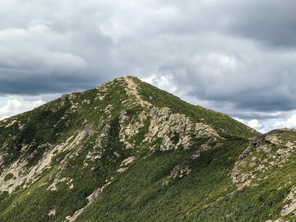
After a 30-minute or so break, it was time to traverse the Franconia Ridge Trail to the north. Part of the Appalachian Trail, it traverses peak after peak, completely above treeline. It’s about as close as you can be to “walking on the top of the world” in New England. This 1.7 mile section of the hike was what I looked forward to the most.
So, downwards I went, only to go up again- the normal pattern for ridge walking. As I came upon the final approach for Mt. Lincoln, I met a lady coming the other way warning me of “a tricky bit” ahead. She was right, there was some scrambling up and over, then around boulders on the way to the top of Lincoln. I arrived in fine shape.
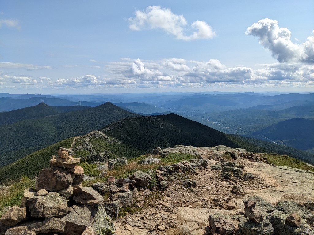
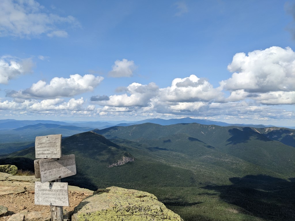
From the top of Lincoln the last stop, Mt. Lafayette hove into view, with a little bump in between called North Lincoln. I wasn’t aware until now that it had its own name, but it apparently fits the description for a mountain peak.

I continued walking to the north, enjoying my time above treeline and not really wanting it to end. Ambling over the North Lincoln bump, I passed some sharp drop offs and got my first view of the next rest stop, the AMC Greenleaf Hut.

The final push to the top of Lafayette wasn’t difficult, but as the trek was approaching the five mile mark, some fatigue was setting in. I was looking forward to the next rest stop down at the hut.
I spent a while at the summit, taking a 360 video and some stills. Chatted briefly with a NOBO AT thru hiker, and a few other trail companions. The trails were busy that day in both directions. I could just imagine how busy they are on weekends. Here’s the video and a slide show of the vista photos.


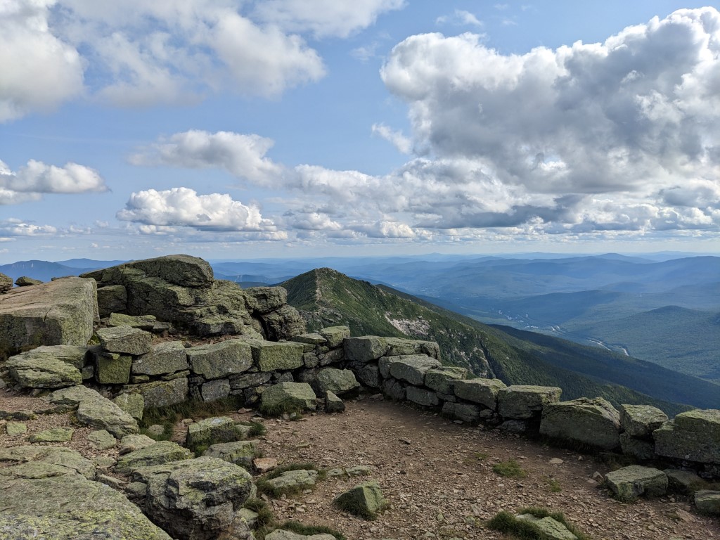

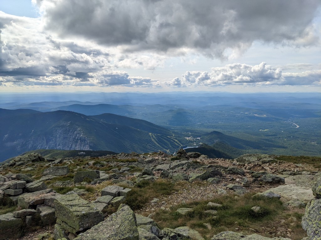
I certainly hit the jackpot weatherwise. Visibility unrestricted!
From the top of Lafayette it’s a little over a mile to Greenleaf Hut, where I planned to pick up the Old Bridle Path trail back to the beginning. It took some adjusting making the transition from up & down to just down, but I still felt in good shape and maintained a steady (slow!) pace, arriving at the hut ready for a rest stop. Off came the pack and the pullover. I refilled a water bottle in the hut and used the bathroom, then lounged upon a rock for a half hour or so, stretching out the quads and hammies which were about to get their downhill workout.

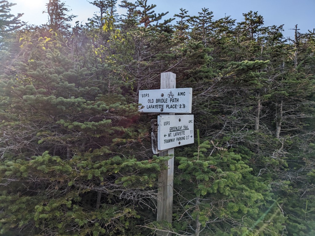
Downhill is harder than uphill, at least, it is for me. I’ll climb all day without complaint, but descending the boulder fields is challenging. Lucky for me, the Old Bridle Path was nothing but boulder fields and ledge for a healthy portion of the 2.9 miles back to the trailhead.
As I’ve said before in posts, my primary goal is to complete each excursion without becoming someone else’s problem. So, slow and steady on the downhill, using the hiking staff where needed for leverage. Triangles and tripods are stable and strong.
Even though I maintained a good pace on the downslope, I was passed several times by “youngsters” blithely hopping from rock to rock, and in a couple of cases running down the damn hill. I used to be able to do that in the dim and distant past. Heh.
I have to give a shout out to “Liam”, who was one of those youngsters. He stopped to talk for a bit, complimenting me on my old school hiking staff, and giving me a fist bump before he continued bouncing down the rock strewn trail. It was a well done example of “checking on the old guy” without being obvious, and was much appreciated.
Eventually I came out of the rock fields and onto more of a forest path, which was a good thing as it was getting dark. Light fades fast in the mountain forests.
The trail was in great shape, and I passed through a construction zone where crews had been cutting stone and building more wilderness staircases on the trail. The work those crews do is difficult, amazing and underappreciated in general. But not by me- those guys and gals rock!
Having to break out the headlamp for the last ⅓ mile, I arrived back at the parking lot just before 9PM. The Transcontinental Jeep wasn’t the only car left in the lot, but it didn’t have much company.
So the longest outing of the season came to an end. Just under 10 miles logged, with 4 mountain peaks traversed and a bit less than 3900 feet of elevation gain. Actual walking time was about 8.5 hours and the overall elapsed time, counting rest, photography and dawdling was 11 hours. There were no insects of consequence. All dogs met on the trail were friendly, if not delightful.
There’s no place I would rather be than walking in the forests and mountains. There’s something about the simplicity of the endeavor that’s attracted me to this for most of my life. Place one foot in front of the other, don’t give up or in and you’ll see and experience things most do not. You’ll also learn a lot about yourself, and where the limits are- they’re further out than you think.
The adventures continue! Thanks for dropping by, and if you enjoy reading about these wanderings, consider making my day by liking and subscribing to this blog.

